
Gereme, A City Hidden On The Left Of Erciyes
Updated: 3 min read
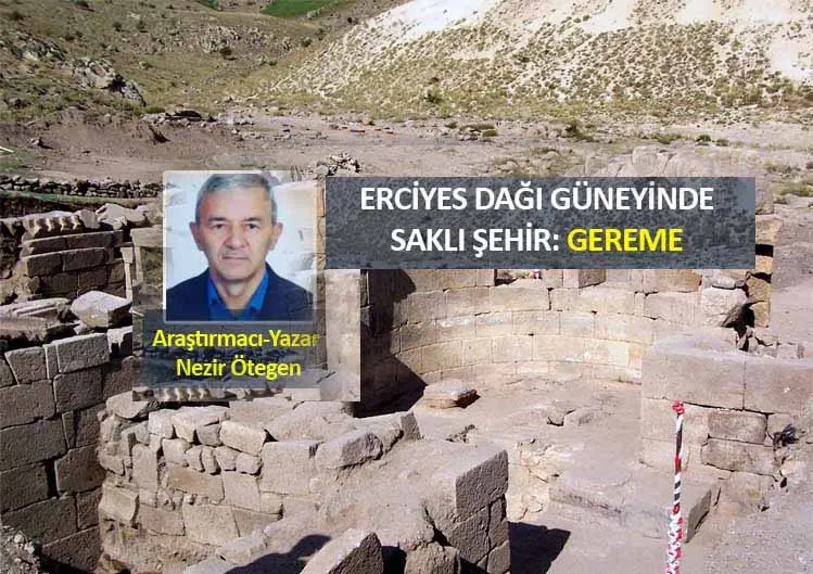
Erciyes Mountain, which has played a major role in shaping the geography and human life in the Central Anatolia region for thousands of years, awaits the discovery of the hidden beauties it contains.
Does Gereme, which has a similar name with Göreme in Nevşehir, have a connection with this region?
Here is one of those beauties GEREME…
Gereme, which has also found its place in the depths of history, was established in the steep valley between Mount Erciyes (Argaios) in the north of Develi. Kalkanlı Hill in the east, Church Mountain (Zeyrek Hill) in the northeast, HatlıKartinHill in the north and GökHill just below, Flat KartinHill and KaraçıklıHill in the west, Kızıl Hill in the southwest, and the plain called Kızıl Yazı Land in the south are the slopes on which Gereme is located thus creating its natural boundaries.
What Researchers Think About Gereme…
As a result of the etymology and historical geography studies related to Gereme in the Antique Studies- Gereme in Ancient Times project by FatihErhan, Research Assistant from Çukurova University, it was determined that the ancient name of the settlement should be "Keramos", apart from its current saying with Göreme, located in Nevşehir. It has been concluded that there is no etymological connection about its current name. He draws attention to the fact that Gereme should have been an Episcopal Center that grew and developed in the 4thcentury and continued to exist in the Byzantine Period.
How It Is Explained In The Sallaname…
In the article of En AgioKonstantino dated 29 August 1902, translated by FehmiDinçer in 2005, from the 1914 KaramanlıcaNevşehir Yearbook; there is a part called Kereme (gereme-sacred place). Its former name is Mekelli and there are famous monastery ruins, waterways, libraries and treasury offices. Next to this monastery was an old city famous for its excellent schools. Two brothers Gallos and Lilianos were educated in these schools. The first information about the Church of Panagia in the northwest of the settlement is found in Hamilton's travel book in 1842.
What Happened In Gereme During The Republican era
Gereme (Korama/Gedeme) City: It is located on the southern slope of Erciyes Mountain and most of the mosques in the city and all of the Civil Architecture remained under the grounddue to the drifting of Volcanic tuffs on steep slopes around the city, earthquakes in 1932 and 1942, floods and some natural factors, while some high houses and some upper parts of the churches are still standing.
In 2005, within the scope of the EU-supported Bread in Ashes Project carried out by Develi Municipality, Kayseri Special Provincial Administration Directorate and İŞKUR, archaeological excavations were carried out with 50 personnel in the Gereme Ruins. The excavations were carried out by Erciyes University Faculty of Letters, under the coordination of Prof. Dr. NilayÇorağan, Lecturer at Art History Department.
According to NilayÇorağan'sremarks about Gereme after the excavation; This 2,000-year-old excavation site is located on an area of 2,900 square kilometers and, with its former name, Kereme-Koroma City, occupied an important place for the Cappadocia region, and the region was named Gabadonia at that time.
Located on a dominant hill and in the north east of the city, there is a chapel as a mountain church and the Panagiabasilikal Church. Church 3 is a basilica planned building for burial purposes. It is dated by researchers to the early Byzantine period (4thcentury Constantine). In addition, a crypt was found under the Berna section of the building. There is also a mausoleum next to the civil structures around the Gereme Churches.
In the lower part of the Gereme Ruins, on the wall of the building, which is presumed to be a bath, well-engraved large stones with or without mortar were used besides terracotta pipesin order to provide ventilation. As it is understood from the minor findings obtained from these trenches, it was revealed that this place was the Late Roman and Early Byzantine period structures.”
There are also caves carved into the rocks on KartinHill, where Gereme leans on its skirts, used as shelters. For these reasons, the Gereme Ruins are important in terms of faith tourism.
Researcher-Author NezirOtegen, 2021 Develi/Gereme
Places in this article
Pages for the places mentioned in this article
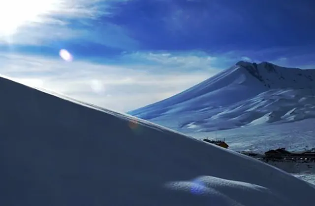
Mount Erciyes
Melikgazi, Kayseri